
Home > Field Offices >
Upper Rio Grande Project (URG)
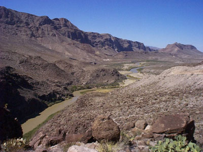
 The Upper Rio Grande Project consists of five separate projects: Canalization, American Dam and Canal, Chamizal, Rectification, and a portion of the Boundary Preservation Project. The Upper Rio Grande Project is operated and maintained as one project. The Project extends along the Rio Grande from Percha Diversion Dam in New Mexico downstream to the tri-county line at the southern end of Hudspeth County, Texas a distance of 270 river miles. The Project is primarily for flood control, river stabilization, and to control the division of waters for beneficial use between the United States and Mexico pursuant to the 1906 Water Treaty with Mexico.
The Upper Rio Grande Project Office is headquartered in El Paso, Texas with two satellite field offices in Las Cruces, New Mexico and Fort Hancock, Texas. The Field Office in Las Cruces is responsible for the Canalization Project. The American Dam Office is responsible for the American Dam and Canal, Chamizal Project, and the segments of both the Rectification and Canalization Projects from the Country Club Bridge in El Paso to Wasteway No. 1 which is located 2.5 miles downstream of the Riverside Dam. The Zacarias Dominguez Field Office is responsible for the Rectification Project and a portion of the Boundary Preservation Project. The projects are discussed in more detailed below.
Responsibilities and Maintenance
Major responsibilities of the Upper Rio Grande Projects staff include maintaining 221 miles of flood control levees, removing obstructions from the floodway, maintaining bridges, measuring flows in the Rio Grande, demarcating the international boundary, and maintaining canals and dams. The objectives of the Upper Rio Grande Project are to economically, effectively, and satisfactorily carry out the purposes for which the Project was designed and constructed.
Project maintenance activities include but are not limited to the following: levee maintenance such as mowing, widening levee bases, filling and repairing washouts, stabilizing, shaping, road grading and surfacing; floodway mowing operations for vegetation to insure that the floodways are capable of handling the design flow capacities; stabilization of river banks; grading and removal of sediment at arroyo mouths and sediment removal within the pilot channel; maintenance of five sediment control dams; maintenance of four grade control structures within the Rectification Project; maintenance of the following International bridges: Bridge of the Americas (Cordova), Fabens - Guadalupe, and Fort Hancock - El Porvenir; clearing of drainage structures such as wasteways and drains; and maintenance of heavy equipment such as dozers, cranes, scrapers, loaders, and tractor-mowers.
Hydrographic Program
The field office manages, plans, and administers the operation and maintenance of an extensive system of river gauges and facilities in the Rio Grande and canal systems for the purpose of securing water accounting data required to meet treaty and domestic requirements.
The American Dam field office obtains hydrographic data necessary to ensure that Treaty provisions for use of the waters of the Rio Grande are carried out. The field office obtains the data necessary to deliver 60,000 acre-ft annually to Mexico, in accordance with the 1906 Convention. In addition, the data is used for flood warning and reservoir operations at the Caballo Dam.
Hydrographic sites: Three flood warning stations and six water accounting stations for water deliveries to Mexico per the 1906 Convention.
Personnel Working for the Upper Rio Grande Project
Presently, thirty-nine field office employees oversee the operation and maintenance of the American and International Dams, Rio Grande Canalization and Rectification Projects and perform daily hydrographic activities.
Rio Grande Canalization Project
The Canalization Project provides a means for carrying out the division of waters of the Rio Grande, under the provisions of the 1906 Water Treaty with Mexico. Under the Treaty, responsibilities include protecting valley lands in the United States from floods, stabilizing the river channel, and improving the drainage of adjacent lands. The Canalization Project was constructed and is being operated and maintained pursuant to the Act of June 4, 1936 (49 Stat. 1463). The Project was completed in 1943 at a cost of $3,892,221. View the current Doña Ana and El Paso County Flood Control Levees Fact Sheets.
1) Purpose
The Rio Grande Canalization Project assures that water released from upstream reservoirs for delivery to Mexico is in compliance with the Convention between the United States and Mexico concluded May 21, 1906 is conveyed effectively to the American Dam, and also provides for protection of lands along the project from floods.
2) Location
The Rio Grande Canalization Project, New Mexico and Texas, extends for 105.6 miles (170 km) along the Rio Grande from the Percha Diversion Dam, located 2.0 miles (3.2 km) below the Caballo Dam, to the American Dam at El Paso.
3) Description of the Project
The Rio Grande Canalization Project consists of a normal flow channel and a leveed floodway. The normal flow channel carries the irrigation releases from the Elephant Butte and Caballo Dams to the headworks of irrigation projects developed by the U.S. Bureau of Reclamation in New Mexico and Texas and also carries waters released for delivery to Mexico under the 1906 Convention. The normal flow channel has a depth of 3 to 5 feet, a width ranging from 110 to 500 feet, and a capacity ranging from 2,500 cfs above Leasburg Dam to 1,200 cfs at El Paso.
The floodway ranges from approximately 50 to 2,100 feet in width. The bordering levees range 3 to 15 feet in height and have a total length of 130 miles with 57 miles on the west side and 73 miles on the east side. In some reaches, the floodway is bounded by natural high ground, and in the section near Canutillo, a railroad embankment forms the east levee. The crown of the levees is gravel surfaced to facilitate access during flood emergencies and for normal maintenance. Some of the floodway lands are used for recreational purposes, and the remainder are largely used for grazing.
No project works were built in an 8.6 mile section in Selden Canyon between the Rincon and Mesilla Valleys in New Mexico where the river is confined within canyons and no channel control works were needed.
4) Operation and Maintenance
The operation and maintenance for the Canalization Project is carried out from one location; the Las Cruces Field Office located in Las Cruces, New Mexico. The Project is 105.6 river miles in length, 130 miles of flood control levees, and 27 bridges. The project also maintains five dams built on adjacent arroyos between 1969 and 1975 to control sediment and flood runoff to the Canalization Project.
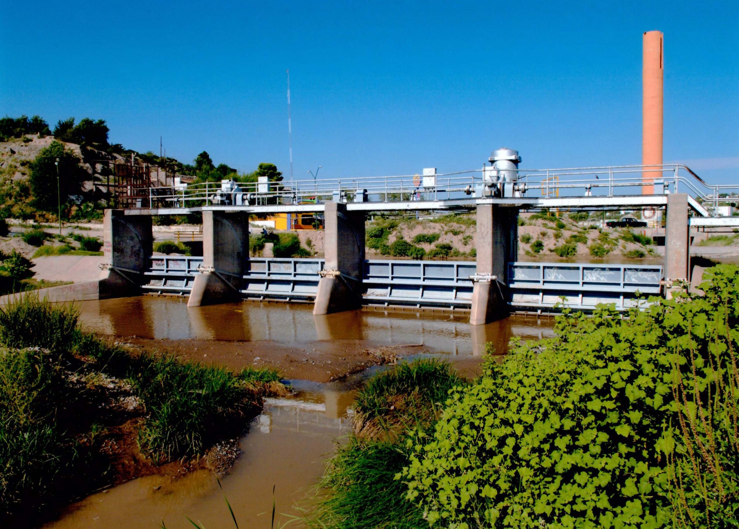
The American Dam and Canal Extension Project
The project extends from the American Dam to the International Dam. The project was constructed and is being operated and maintained under the authority of, and pursuant to the Act of August 29, 1935 (49 Stat. 961). The American Dam and Canal Project provides the means for physical control and division of waters in the Rio Grande River. The river water allocation for each country (United States and Mexico) is addressed in the 1906 Treaty. The Project was completed in 1938 at a cost to the United States Government of $667,398. The Operation and Maintenance of this project is carried out by the American Dam Field Office, situated in El Paso, Texas. The American Canal was recently extended (Rio Grande American Canal Extension) and is located adjacent to the Rio Grande from the International Dam to the Riverside Dam, a distance of 12.0 miles.
1) Purpose
The American Dam was constructed to regulate the quantity of water delivered to Mexico and the United States irrigators from the Rio Grande under the 1906 Convention by diverting the United States allotment of water to the American Canal for United States irrigators and releasing to the river downstream the waters allotted to Mexico.
2) Location
The American Dam, constructed wholly within the United States, is located on the Rio Grande about 3.5 miles upstream from the business center of El Paso, Texas and about 140 feet above the point of beginning of the Western Land Boundary between the United States and Mexico.
3) Description of Project
The diversion dam, constructed in 1937-1938, is 284 feet long and contains thirteen radial gates. Water enters the American Canal over a weir, which is parallel to the general course of the river. Intake control into the American Canal is by means of two radial gates. Downstream of the intake structure, the canal follows the left bank of the river a distance of 2.0 miles downstream to connect with the Rio Grande American Canal Extension (RGACE). Water for the portion of the Rio Grande Reclamation Project is carried through the RGACE. The RGACE terminates at the Riverside Canal Heading, just downstream of the Ysleta-Zaragoza International Bridge, a distance of approximately 12 miles.
4) Operation and Maintenance
The American Dam and American Canal are maintained by the U.S. Section personnel under the direction of the El Paso's Project Field Office at the American Dam (Upper Rio Grande Projects). The RGACE is maintained by the El Paso County Water Improvement District No. 1 through a Memorandum of Understanding.
Presidio Project Office
 The Presidio Flood Control Project provides flood protection to urban, suburban and agricultural lands, and stabilizes the international boundary. The Project is 15.2 miles in length and is located along the Rio Grande within the sister cities of Presidio, Texas and Ojinaga, Chihuahua. The United States and Mexico is responsible for the maintenance of its portion of the facilities and floodway.
The jurisdictional limits of the office extend along a 400 mile stretch of the Rio Grande from the Presidio, Hudspeth, Jeff Davis tri-county line to Heath Canyon, Texas.
Responsibilities include:
- Flood control to protect urban, suburban, and agricultural lands, and against loss of life and property.
- Maintenance of 15.2 miles of levee, including vegetation control.
- Semi-annual mowing of 400 acres of floodway.
- Operation and maintenance of twelve flood warning, water accounting, rainfall and evaporation stations.
- Collection of samples for the Texas Clean Rivers Programs and other water quality monitoring programs.
- Coordination with local, state and federal agencies; landowners and the general public on issues pertaining to the operation and maintenance of the Project.